In 1896 a fellow by the name of George Carmacks and his companions discovered gold in the headwaters of what was then known as Rabbit Creek, a tributary to the Klondike in the Yukon territory. Their discovery caused and uproar that sent thousands and thousands of men and women from across the world scurrying like ants into the Yukon. It was aptly described as a stampede. But it wasn’t as easy (or fast) as that. There was no roads, no infrastructure, and easiest way in and out, wasn’t really all that easy: the ancient Tlingit trade route over the Chilkoot Pass.
You’ve probably seen the pictures. Images of lines of hundreds of men walking in lock step up a steep and snowy pass? They were laden with equipment, more than a thousand pounds per person, that required dozens of trips up and down the 33 mile trail to transport. These people were tough as nails, I tell you.
When the gold played out, and word of new discoveries in Alaska’s interior and near Nome trickled out, the stampeders disappeared down the Yukon River and the Chilkoot Trail fell into disuse. But the photos and stories remained and embedded themselves in romantic mystery. Today, the trail remains, and it has become something of a mecca for backpackers. In fact, it is probably the most hiked trail of its length in either Alaska or the Yukon.
A couple of weeks back, along with my parents and partner Amy, I hiked it. My mother, the unique and wonderful woman that she is, wanted to do something special to commemorate her 70th year. And that something special was to emulate the stampeders of 1899 and hike the entire Chilkoot Trail from Skagway, Alaska to the ghost town of Bennett British Columbia.


The Hike
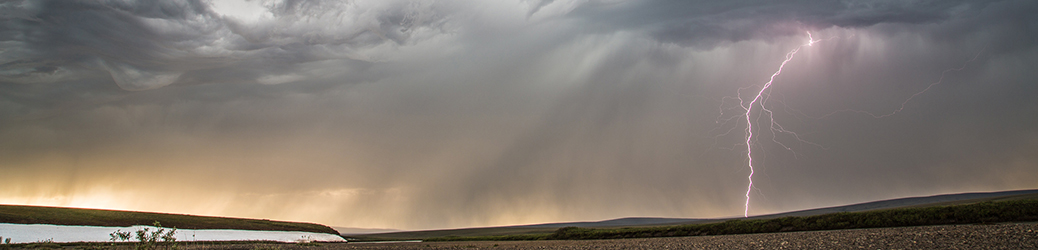
Southeast Alaska is a soggy place. The land is covered in rich forests of tall spruce and hemlock. The trail begins at the old town site of Dyea in just such a forest. Not wasting any time, the trail immediately climbs up a steep, 500 foot hill. Big rocky steps guide the way, and we pushed our way up and over them, ascending slowly under the weight of our packs. At the top, we descended, losing nearly every foot we gained along the previous climb until the trail again flattened at the valley bottom along the river. There, we picked up the pace, passing over beaver ponds atop elevated boards and wandering along the glacial blue Taiya River. Some 7.5 miles later we arrived at our first camp at the former townsite of Canyon City. Drizzle, our new, almost companion joined us that evening, but the old cabin provided for a cooking area by the National Park Service provided ample space to get out of the wet when needed.

In the morning, we set off for what we were told would be the “mellow” hike to Sheep Camp, the easiest, and shortest day of our trip. Though only five miles, the route wandered up and up, ascending a short, but wickedly steep stretch of trail just a mile from our previous night’s camp. Up and down, up and down, across swaying suspension foot bridges and eventually climbed up toward the scattered array of tent platforms that make up Sheep Camp. In 1898 and 99 thousands of people would have been found there. A city of wall tents stretching up and down the valley, perched atop every piece of flat ground. We made for bed early, knowing that the next day would bring the longest and certainly most arduous day of hiking.


We woke early, but yet still took longer than I’d hoped to start out of Sheep Camp. It was “Summit Day” and would include 8 miles of hiking and nearly 3000 feet of elevation gain. It started right away on the aptly named “Long Hill” which carried us up 1400 vertical feet in three miles to the Scales. The Scales were where the stampeders got their mountains of equipment weighed, assuring they had the required amount of supplies to survive a year in the Yukon. Now, little remains of the camp except for rusted pieces of metal, cables, and rotting beams. We paused at the scales to consume some calories in preparation for the next obstacle: the infamous Golden Staircase. It began to rain. Not the drizzle we’d grown accustomed to but malevolent, brutal, windblown rain. Not wanting to prolong the chill, Amy and I started out, my parents and the rest of our group following a short distance behind. It was a short walk over wet slick stones and a long snow field to the base of the “staircase”. Despite the name, there were no stairs. Rather we found a great boulder field steepening up the mountainside before disappearing into the fog a few hundred feet over our heads. The entirety of the thing was lost to the fog. Perhaps a blessing in disguise? We set foot on the first rocks and began the long ascent. Feet and hands clinging to wet rocks, we clambered upward, following the worn stones where thousands of feet and hands had cleared the lichens from the rock. The flats below us disappeared into the fog and the the top remained hidden. We were alone in the mist and rain. We paused atop a false summit (one of a few) and waited for my parents who were not far behind. They were up-beat, cheerful even, as they climbed. They were used to hiking at 10,000 feet in the mountains of Colorado and despite the challenging terrain, were having little difficulty. It took another couple of false summits before the pass finally leveled out and led us to the Canadian border where a warming hut was filled with the heat of a dozen people and camp stoves boiling water for drinks. I was reminded that this was no wilderness experience as we shouldered our way in to wait for the rest of the group. The many other hikers trickled out, eventually, leaving just our group behind and we had lunch in the relative comfort of the dry (if humid) hut. The final miles of the day carried us down several hundred feet, and out of the fog and rain of the Alaska side of the pass. We passed through alpine tundra, over snow fields, and along the first of a series of blue glacial lakes. The sun even emerged, briefly, to dry our sopping rain gear. It was a long walk to Happy Camp. But, as the name implied, we indeed arrived happy, or perhaps just relieved.


The next morning dawned in mosaic of lifting fog and patchy sun. I got up early and went for a walk with my camera. The sounds of snoring rose from most of the tents scattered atop the platforms at the camp. I walked down to the nearby creek and made a few images of the melting snow fields, the wildflowers and the rocky tundra. The Canadian side of the pass reminds me much more of the Rockies than of the mountains of Alaska. Eventually, I walked back up to camp, had breakfast, packed up gear and waited for the rest of the group to be ready. It took some time. The first stretch of the day’s hike took us from Happy Camp to Deep Lake. It was a slow (agonizingly so) three miles, as the older folks, who made up most of our group were stiff and tired after the previous long day. At Deep Lake, after lunch, Amy and I took off by ourselves down the trail. Alone with our packs for the first time during the trip we moved quickly. The trail was a long, gradual descent to Lindemann Lake. Easy walking over increasingly dry and sunny terrain. We descended into Lodgepole Pine forest a short distance from the lake and I could have sworn I was back in the front range of Colorado. The smells, the dry underbrush, and the sandy soil, all took me back to the many hikes I’ve made over the years in the central Rockies. At Lindemann we dunked our feet into the stream at the old townsite and took a half hour to bask in the sun. Then, the rest of our group, still not arrived, we took off again toward the night’s camp at Bare Loon Lake. This was a surprisingly long stretch of rolling, almost slick-rock trail. The route followed a ridge of glacially sculpted bedrock. Up an down, up and down. Fifty vertical up, fifty vertical down. The final three miles felt almost endless, but eventually we arrived at Bare Loon Lake, and were greeted, appropriately, by the call of a Common Loon flying overhead.


The final day carried us about 7 miles from Bare Loon along Lake Lindemann to the headwaters of Bennett Lake to the Ghost town, turned tourist train stop of Bennett, British Columbia. It wasn’t a difficult day, but atop the four days before, it felt long. Tired legs were not relieved by the final couple of miles which were covered in several inches of windblown sand. The scenery, however, was spectacular and there were constant reminders of the passage of the stampeders 115 years before. There were scattered cans, old cabin sites, and just outside Bennett, a touching graveyard. Some of the headstones were too worn to read, but others could still be made out. A woman, aged 38, men in their 60s, mounties who died in the line of service. It was a snapshot of the people who lived (and died) in the few hard years of the gold rush. Eventually, we found our way to the train station where the other trekkers greeted each new arrival with a round of applause. My parents were none the worse for wear, and I was (and am) as proud of them as could be. Few 70+ year olds would dare venture out on any kind of backpacking trip, but my folks were willing to take on a tough one. I’ll gladly brag about that.

In all, the Chilkoot was not a wilderness experience, at least not by my decidedly skewed standards. There was a constant stream of people up and down the trail, and the camps were villages of tents and warming huts, crowded at times. I see this more as an abbreviated Appalachian Trail. It’s a cultural, social, and historical experience. But one with constantly shifting scenery, physical challenges, and even, I suppose, a bit of risk. I’d walk the trail again, though I suspect I won’t. There are too many places in Alaska yet to visit, too many wild corners left to explore just to repeat one that I’ve already done. Like most of the Stampeders, the Chilkoot is a trail that I need walk only once.